Platform for Integrating Complex 3D, IIoT and Metadata for Viewing and Interacting on Mobile Devices
VR / AR /SLAM
GIS Positioning
Image Recognition / Segmentation
Artificial Intelligence
Technology | Consulting | Integration
Harness the power of HPC for the most complex 3D and non-3D data digital twin projects.
Highly customizable for crunching, combining, and displaying big data on typical browsers and delivered to any number of users simultaneously.
Direct application for valuable capital assets, large infrastructure, and smart cities.
Flexibility
Format Agnostic
Combine CAD, LIDAR, Geo-spatial, Photogrammetry.
Device Agnostic
View and interact with big 3D data without compromising detail on mobile devices, or wearables of your choice.
Cloud Agnostic
Use Azure, AWS, Google, or IBM.
BujiBui is for Digital Twins
Aimed at modern problems.
Complexity of Data
For projects that require the means to interpret and even visualize expansive, complex, multi-dimensional and spatial data in real-time.
Volume of Data
Where you are facing an inordinate amount of volume of data, including a large degree of historic data or data generated at great velocity, typically within environments that leverage dynamic spatial data (e.g. quickly changing environmental data with spatial markers) or aggregated sensor data from an array of sensors and/or with rapid signaling requirements.
Acceleration of Data Growth
For projects facing a dramatic acceleration of spatial or multi-dimensional data growth, such as industries that employ an increasing number of sensors, high transactional volumes, combined with a regulatory, legislated, or practical need to archive long periods of data.
Accessibility of Data
For projects that require access to specific dimensions of data (i.e. location, time, asset, condition) within a narrow scope, but within the context of remote use where broadband data connectivity may be limited. Examples may include remote geographic operations.
Rapid Visual Interpretation of Data
For projects that require timely (even immediate) visual interpretation of data, including complex decision support, accommodating dynamic environmental factors.
Justifiable Project Costs
When solutions cobbled together or from other vendors to be ineffective or cost-prohibitive.
Interact with Very Large 3D Data
Combine CAD, LIDAR, Geo-spatial, Photogrammetry. AI and Machine Learning to assist in 3D model generation.
Integrate IIoT Data
Integrate live feeds from asset sensors or display enterprise metadata.
Low Powered Devices
Display large amounts of 3D data without compromising detail on mobile devices, thin clients with low memory and computing capability.
High Performance Computing
Utilize cloud-based parallel processing and HPC only once when new data is introduced to model. Extremely efficient.
Large number of users
Accessible by common web browsers.
mobile satellite connectivity
Access all data by Wi-Fi, 3G/4G/5G and Satellite Broadband.
AR & VR
Connect digital models to the physical world in Augmented Reality (AR) and Virtual Reality (VR) modes.
How do we do it?
BujiBui can be classified into three broad areas.
BujiBui efficiently integrates technologies commonly used in the creation of 3D digital twins, such as CAD, Internet of Things sensor data, Enterprise Asset Management, Geographic Information Systems (GIS), simulations, Simultaneous Localization and Mapping (SLAM) and Artificial Intelligence (AI) into a customizable solution. Using the power of high-performance computing and parallel processing, we reduce tedious manual work and time required to create a 3D digital model saving money.
COLLECTION, PROCESSING, AND AUTOMATIC 3D MODEL GENERATION
Use existing files or Machine Learning, Artificial Intelligence, Semantic Image Segmentation to work with point cloud data.
ENHANCEMENTS
Connecting with 3D Data and non-3D Metadata, SLAM, and Simulations.
VISUALIZATION AND DELIVERY
Access the power of High Performance Computing for VR, AR, Conventional Screens, and Mobile Devices.
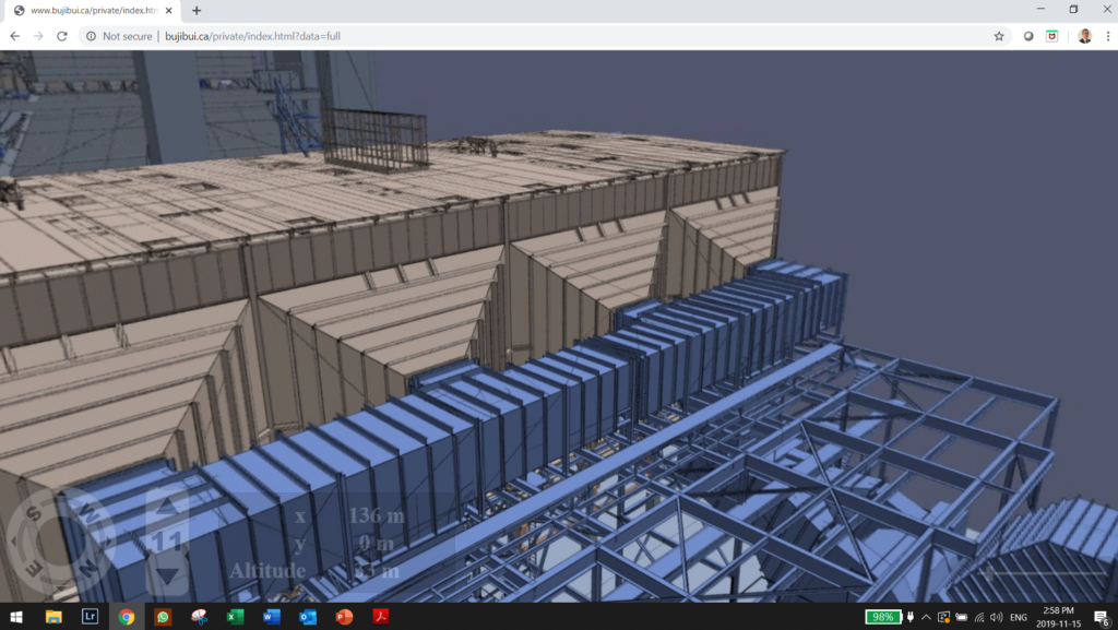
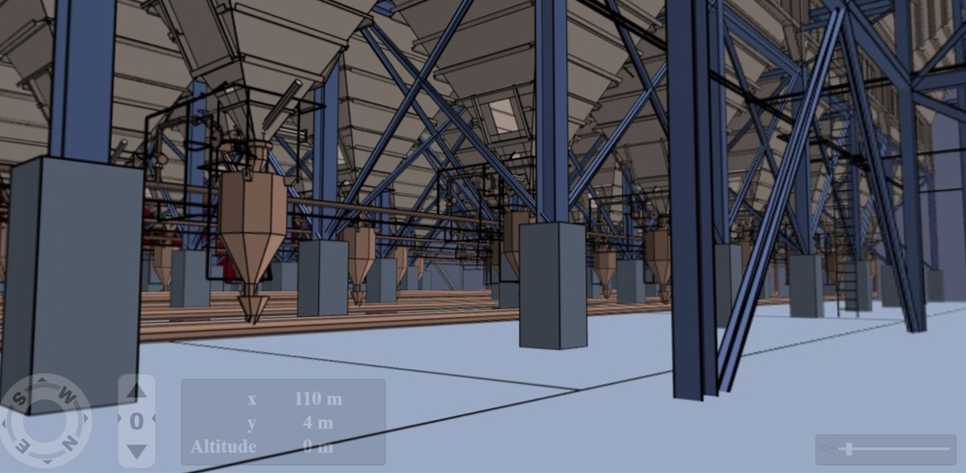
Thermal Power Plant - conventional browser mode


